


Merrifield Voting District, Fairfax County, Virginia
About
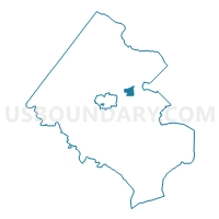
Outline

Summary
| Unique Area Identifier | 681552 |
| Name | Merrifield Voting District |
| County | Fairfax County |
| State | Virginia |
| Area (square miles) | 1.38 |
| Land Area (square miles) | 1.38 |
| Water Area (square miles) | 0.00 |
| % of Land Area | 99.97 |
| % of Water Area | 0.03 |
| Latitude of the Internal Point | 38.87717510 |
| Longtitude of the Internal Point | -77.22918620 |
Maps


Graphs
Select a template below for downloading or customizing gragh for Merrifield Voting District, Fairfax County, Virginia


Neighbors
Neighoring Voting District (by Name) Neighboring Voting District on the Map
- Mantua Voting District, Fairfax County, VA
- Pine Ridge Voting District, Fairfax County, VA
- Pine Spring Voting District, Fairfax County, VA
- Stenwood Voting District, Fairfax County, VA
- Timber Lane Voting District, Fairfax County, VA
- Walker Voting District, Fairfax County, VA
- Woodburn Voting District, Fairfax County, VA
Top 10 Neighboring County Subdivision (by Population) Neighboring County Subdivision on the Map
Top 10 Neighboring Place (by Population) Neighboring Place on the Map
- Annandale CDP, VA (41,008)
- West Falls Church CDP, VA (29,207)
- Idylwood CDP, VA (17,288)
- Merrifield CDP, VA (15,212)
- Dunn Loring CDP, VA (8,803)
- Woodburn CDP, VA (8,480)
- Mantua CDP, VA (7,135)
Top 10 Neighboring Unified School District (by Population) Neighboring Unified School District on the Map
Top 10 Neighboring State Legislative District Lower Chamber (by Population) Neighboring State Legislative District Lower Chamber on the Map
Top 10 Neighboring State Legislative District Upper Chamber (by Population) Neighboring State Legislative District Upper Chamber on the Map
Top 10 Neighboring 111th Congressional District (by Population) Neighboring 111th Congressional District on the Map
Top 10 Neighboring Census Tract (by Population) Neighboring Census Tract on the Map
- Census Tract 4401, Fairfax County, VA (7,135)
- Census Tract 4617, Fairfax County, VA (6,594)
- Census Tract 4616.01, Fairfax County, VA (6,237)
- Census Tract 4402.02, Fairfax County, VA (5,815)
- Census Tract 4501, Fairfax County, VA (5,442)
- Census Tract 4506.01, Fairfax County, VA (4,023)
- Census Tract 4616.02, Fairfax County, VA (3,916)
- Census Tract 4713.03, Fairfax County, VA (3,887)
- Census Tract 4606, Fairfax County, VA (3,849)
- Census Tract 4714.02, Fairfax County, VA (3,495)